Tesoro & Southbend waterfront planning
Creek, seawall and lake bank planning in Tesoro and Southbend, Port St. Lucie: Winters and Blakeslee creeks, the CDD, Vikings Lookout and permits.
Describe your project on this page ↓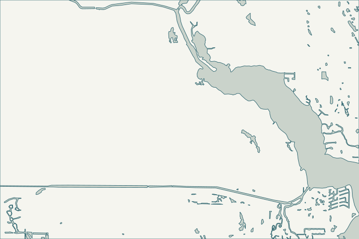
Get to know your waterfront
At the south end of Port St. Lucie, the Tesoro Community Development District (established 2005) touches Winters Creek and Blakeslee Creek, tributaries of the North Fork, while Tesoro’s internal lakes form a separate freshwater system. Nearby, the city places Vikings Lookout and Bay St Lucie in the Southbend Lakes neighborhood.
St. Lucie County Community Development Districts layer (Name, Ordinance, DateEstabl fields) · USGS National Hydrography Dataset flowlines · Port St. Lucie Subdivisions layer
Creek lots versus lake lots
Tidal creek and river lots follow the North Fork rules: aquatic preserve, mangrove trimming limits, and state and federal approvals for docks. Lake lots are different: the bank is often a common-area tract owned by the district or association.
Before hiring anyone for lake-bank erosion, confirm the tract ownership on your plat and ask the district what its SFWMD permit requires. St. Lucie County Community Development Districts layer (Name, Ordinance, DateEstabl fields) · North Fork, St. Lucie Aquatic Preserve · Agreement to Rebate Stormwater Assessments and Provide for Maintenance of Stormwater Management System for Riverland Communities
What could the work cost?
Get separate scopes for creek-front walls and lake-bank work; they have different owners, permits and contractors.
Published examples are attributed context from Treasure Coast and nearby South Florida sources, not a Port St. Lucie average or a quote. Your wall needs a property-specific written scope.
Compare quotes and plan a budget →Find the relevant permits and records
| Starting point | What to resolve | Prepare and look up |
|---|---|---|
Port St. Lucie Building Department | City permit for the seawall (permit type SWL), dock (DK) or boat lift (BL). | Sealed plans, plot plan with setbacks and Notice of Commencement for work of $5,000 or more. 772-871-5132. |
FDEP, Army Corps and SFWMD | State exemption or permit, federal authorization and water-management approval the city asks to see. | Show the new wall face relative to the old one (18-inch rule). FDEP Southeast District: 561-681-6600. |
Association or community development district | Lake tract ownership, lake-bank maintenance and architectural approval. | Plat, declaration and the SFWMD permit for the community stormwater system. |
A Tesoro and Southbend checklist
Use these steps to gather records and prepare a property-specific conversation. Public records and project references do not describe the condition of your wall.
Pull the permit history
Search the address on the city or county permit portal for seawall, dock and lift permits and their final inspections before the first site visit.
Check the plat
Find whether the shoreline is your lot or a district/association tract.
Contact the district first
For lake banks, ask the CDD or association before any work at the water’s edge.
St. Lucie County Community Development Districts layer (Name, Ordinance, DateEstabl fields)
Follow mangrove rules on creeks
Natural creek edges are common; trimming and wall work near mangroves follow state rules.
Get help with your Tesoro & Southbend seawall
Tell us what has changed and how to reach you. We’ll help you work out the next step; photos and measurements can follow later.
Tesoro & Southbend project questions
Who maintains Tesoro’s lake banks?
Usually the community development district or association; confirm with your plat and the district.
St. Lucie County Community Development Districts layer (Name, Ordinance, DateEstabl fields) · Agreement to Rebate Stormwater Assessments and Provide for Maintenance of Stormwater Management System for Riverland Communities
Are the creeks in the aquatic preserve?
The North Fork preserve follows state-owned submerged lands below mean high water; ask FDEP whether your creek frontage is included.
Keep planning
Nearby waterfront guides
Sandpiper Bay, Harbour Ridge, Canal Pointe & Kingsway, Palm City
Show sourcesHide sources
- St. Lucie County Community Development Districts layer (Name, Ordinance, DateEstabl fields)Source reviewed 2026-10-25
- USGS National Hydrography Dataset flowlinesSource reviewed 2026-10-25
- Port St. Lucie Subdivisions layerSource reviewed 2026-10-25
- North Fork, St. Lucie Aquatic PreserveSource reviewed 2026-10-25
- Agreement to Rebate Stormwater Assessments and Provide for Maintenance of Stormwater Management System for Riverland CommunitiesSource reviewed 2026-10-25
- Building DepartmentSource reviewed 2026-10-25
- Permit Type Codes (permittypebytypecode.pdf)Source reviewed 2026-10-25
- Building Department Checklist for Dock PermitsSource reviewed 2026-10-25
- Florida Statutes s. 403.813 - Permits issued at district centers; exceptionsSource reviewed 2026-10-25
- Southeast DistrictSource reviewed 2026-10-25
- St. Lucie County Subdivisions layerSource reviewed 2026-10-25
- DEP issues final order to punish Port St. Lucie resort for destroying mangrove forest (Katie Delk, Jan. 2024)Source reviewed 2026-10-25