Harbour Ridge waterfront planning
Marina, seawall and dock planning at Harbour Ridge Yacht & Country Club: St. Lucie County permits, Winters and Blakeslee creeks and the preserve.
Describe your project on this page ↓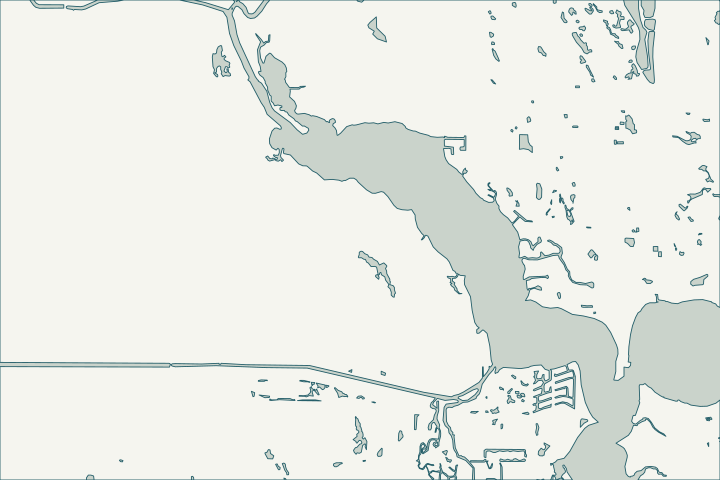
Get to know your waterfront
Harbour Ridge Yacht & Country Club is platted as at least 21 Harbour Ridge plats and villages, and the county’s boundary layer places it in unincorporated St. Lucie County, not Palm City or Port St. Lucie. Its plats touch Winters Creek and Blakeslee Creek near the south end of the North Fork.
St. Lucie County Subdivisions and Municipal Boundaries layers · USGS National Hydrography Dataset flowlines
Marina bulkheads and natural bluffs
Riverfront and marina structures sit in brackish water near the preserve’s southern reach, so bulkheads and docks face corrosion and storm surge. Shoreline changes on natural bluffs and creeks are tightly regulated, and club architectural rules add another approval.
Commercial and multi-slip work usually falls outside single-family state exemptions; in aquatic preserves, docks are limited to 500 feet or 20% of the waterbody width. North Fork, St. Lucie Aquatic Preserve · Fla. Admin. Code R. 18-20.004 - Management Policies, Standards, and Criteria
What could the work cost?
Marina and common-area work is an association decision; get engineering scopes that separate bulkheads, docks and dredging.
Published examples are attributed context from Treasure Coast and nearby South Florida sources, not a Port St. Lucie average or a quote. Your wall needs a property-specific written scope.
Compare quotes and plan a budget →Find the relevant permits and records
| Starting point | What to resolve | Prepare and look up |
|---|---|---|
St. Lucie County Building & Code Regulation | County marine permit for unincorporated parcels: seawalls, bulkheads, riprap, docks, piles. | Marine Construction Checklist; agency approvals uploaded with the submittal. 772-462-1553. |
FDEP and Army Corps | State exemption or permit and federal authorization required at upload. | FDEP Port St. Lucie office per county checklist: 772-398-2806; Southeast District 561-681-6600. |
FDEP state lands (aquatic preserve) | Consent to use state-owned bottom land in the North Fork St. Lucie Aquatic Preserve. | Ask whether the wall moves more than one foot waterward; preserve dock standards apply. |
A Harbour Ridge checklist
Use these steps to gather records and prepare a property-specific conversation. Public records and project references do not describe the condition of your wall.
Pull the permit history
Search the address on the city or county permit portal for seawall, dock and lift permits and their final inspections before the first site visit.
Confirm the parcel is county
Use the county parcel record; mailing addresses say Palm City.
St. Lucie County Subdivisions and Municipal Boundaries layers
Separate private and common shoreline
Identify which walls and docks are the club’s.
St. Lucie County Subdivisions and Municipal Boundaries layers
Plan for manatee conditions
In-water work typically follows FWC standard manatee conditions.
Get help with your Harbour Ridge seawall
Tell us what has changed and how to reach you. We’ll help you work out the next step; photos and measurements can follow later.
Harbour Ridge project questions
Who permits work at Harbour Ridge?
St. Lucie County Building & Code Regulation, plus FDEP and Army Corps for in-water work.
St. Lucie County Subdivisions and Municipal Boundaries layers · Marine Construction Checklist (Building & Code Regulation)
Which manatee zones apply?
St. Lucie County’s zones in Rule 68C-22.008.
Keep planning
Nearby waterfront guides
Tesoro & Southbend, Sandpiper Bay, North River Shores, Palm City
Show sourcesHide sources
- St. Lucie County Subdivisions and Municipal Boundaries layersSource reviewed 2026-10-25
- USGS National Hydrography Dataset flowlinesSource reviewed 2026-10-25
- North Fork, St. Lucie Aquatic PreserveSource reviewed 2026-10-25
- Fla. Admin. Code R. 18-20.004 - Management Policies, Standards, and CriteriaSource reviewed 2026-10-25
- Permitting ContactsSource reviewed 2026-10-25 · official indexed text
- Marine Construction Checklist (Building & Code Regulation)Source reviewed 2026-10-25 · official indexed text
- Standard Manatee Conditions for In-Water Work (2011)Source reviewed 2026-10-25
- Chapter 68C-22 Manatee Protection Rules (rule list)Source reviewed 2026-10-25