Indian River Drive lagoon-front planning
Lagoon-front seawalls, riprap and docks on Indian River Drive south of Fort Pierce: storm washouts, seagrass, county permits and living shorelines.
Describe your project on this page ↓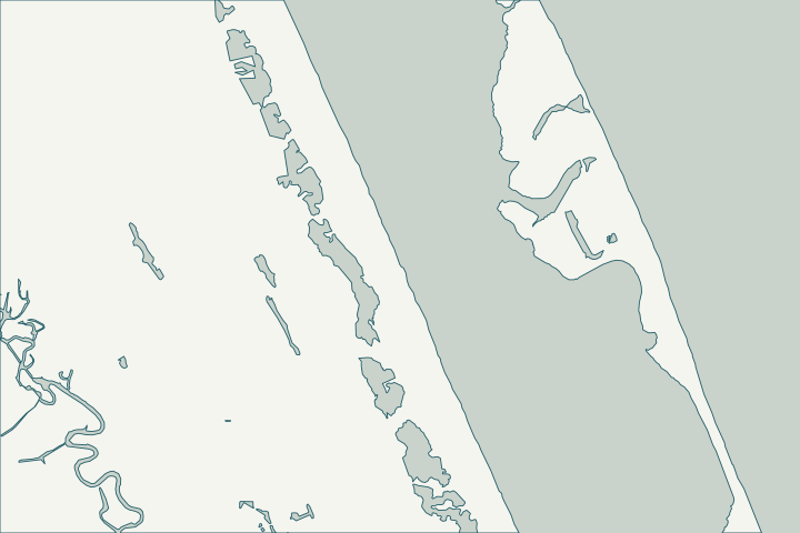
Get to know your waterfront
Indian River Drive runs along the Indian River Lagoon between Fort Pierce and the Martin County line, past historic places USGS names Ankona, Eden, Eldred and Walton. Indian River Estates, an unincorporated community of about 6,600 residents, touches the lagoon here.
USGS Geographic Names (populated places layer) · TIGERweb Census 2020 Census Designated Places layer (POP100, HU100 fields) · USGS NHD area layer
Wide fetch, washouts and seagrass
Lagoon-front walls take wind-driven waves across a wide fetch. Hurricane Frances washed out a one-mile section of Indian River Drive along the waterway in 2004, and Nicole caused washouts again in 2022.
Where seagrass is present, dock and riprap placement are constrained. When a permit is needed to repair a vertical wall on open lagoon frontage, Florida’s agencies generally require riprap facing or replacement with riprap. NWS Melbourne Storm Surveys: Hurricane Frances (September 4-5, 2004) · IMAGES: Tropical Storm Nicole's impacts in South Florida · Florida Statutes s. 373.414 - Additional criteria for activities in surface waters and wetlands
What could the work cost?
Ask for a riprap or living-shoreline alternative priced next to any vertical-wall proposal, and for barge versus land access costs.
Published examples are attributed context from Treasure Coast and nearby South Florida sources, not a Port St. Lucie average or a quote. Your wall needs a property-specific written scope.
Compare quotes and plan a budget →Find the relevant permits and records
| Starting point | What to resolve | Prepare and look up |
|---|---|---|
St. Lucie County Building & Code Regulation | County marine permit for unincorporated parcels: seawalls, bulkheads, riprap, docks, piles. | Marine Construction Checklist; agency approvals uploaded with the submittal. 772-462-1553. |
FDEP and Army Corps | State exemption or permit and federal authorization required at upload. | FDEP Port St. Lucie office per county checklist: 772-398-2806; Southeast District 561-681-6600. |
FDEP state lands (Indian River Lagoon preserve) | Consent to use state-owned bottom land in an Indian River Lagoon aquatic preserve. | Docks limited to 500 ft or 20% of waterbody width; access walkways 4 ft wide. |
An Indian River Drive checklist
Use these steps to gather records and prepare a property-specific conversation. Public records and project references do not describe the condition of your wall.
Pull the permit history
Search the address on the city or county permit portal for seawall, dock and lift permits and their final inspections before the first site visit.
Confirm city or county
Parts of the corridor are Fort Pierce; most is unincorporated county.
Survey seagrass early
Docks and riprap cannot fill seagrass; plan a survey before design.
Fla. Admin. Code R. 62-330.431 - General Permit for Installation of Riprap
Consider toe riprap
A noticed general permit covers riprap at the toe of an existing wall.
Fla. Admin. Code R. 62-330.431 - General Permit for Installation of Riprap
Get help with your Indian River Drive seawall
Tell us what has changed and how to reach you. We’ll help you work out the next step; photos and measurements can follow later.
Indian River Drive project questions
Is the lagoon here an aquatic preserve?
The Indian River–Vero Beach to Fort Pierce and Jensen Beach to Jupiter Inlet preserves cover parts of the lagoon; both are Outstanding Florida Waters.
Florida Statutes s. 258.39 - Boundaries of preserves · Fla. Admin. Code R. 62-302.700 - Special Protection, Outstanding Florida Waters, Outstanding National Resource Waters
Which manatee zones apply?
St. Lucie County’s zones in Rule 68C-22.008.
Keep planning
Nearby waterfront guides
White City, River Park, South Hutchinson Island, Jensen Beach
Show sourcesHide sources
- USGS Geographic Names (populated places layer)Source reviewed 2026-10-25
- TIGERweb Census 2020 Census Designated Places layer (POP100, HU100 fields)Source reviewed 2026-10-25
- USGS NHD area layerSource reviewed 2026-10-25
- NWS Melbourne Storm Surveys: Hurricane Frances (September 4-5, 2004)Source reviewed 2026-10-25
- IMAGES: Tropical Storm Nicole's impacts in South FloridaSource reviewed 2026-10-25
- Florida Statutes s. 373.414 - Additional criteria for activities in surface waters and wetlandsSource reviewed 2026-10-25
- Permitting ContactsSource reviewed 2026-10-25 · official indexed text
- Marine Construction Checklist (Building & Code Regulation)Source reviewed 2026-10-25 · official indexed text
- Florida Statutes s. 258.39 - Boundaries of preservesSource reviewed 2026-10-25
- Fla. Admin. Code R. 18-20.004 - Management Policies, Standards, and CriteriaSource reviewed 2026-10-25
- Fla. Admin. Code R. 62-302.700 - Special Protection, Outstanding Florida Waters, Outstanding National Resource WatersSource reviewed 2026-10-25
- Fla. Admin. Code R. 62-330.431 - General Permit for Installation of RiprapSource reviewed 2026-10-25
- Chapter 68C-22 Manatee Protection Rules (rule list)Source reviewed 2026-10-25