
Causeway Island & Harbour Isle planning
Seawall planning on Causeway Island and Harbour Isle in Fort Pierce: inlet currents, condo association walls, CCCL and city permits on Seaway Drive.
Describe your project on this page ↓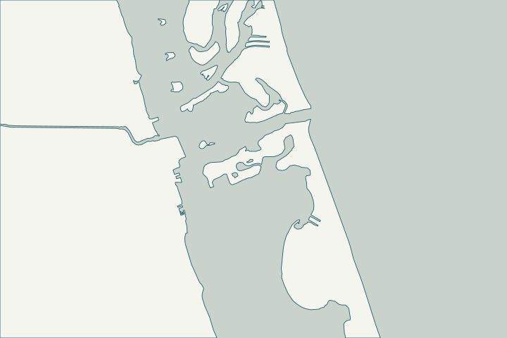
Get to know your waterfront
Causeway Island sits in the lagoon just west of the Fort Pierce Inlet along Seaway Drive. County records show Harbour Isle at Hutchinson Island and its east and west condominiums there, inside Fort Pierce city limits, and the city lists Causeway Park among its parks.
USGS Geographic Names (islands; channels) · St. Lucie County Subdivisions and Municipal Boundaries layers · About Fort Pierce
Inlet tides about twice the North Fork’s
Inlet-adjacent walls see stronger tidal flows than the river canals. NOAA’s Fort Pierce Inlet station shows a mean tide range of about 2 feet, double the North Fork’s.
Condominium associations typically own these walls, so the seawall belongs in the reserve and inspection discussion. Datums for 8722213, Fort Pierce Inlet, Binney Dock FL · Condominiums and Cooperatives — FAQs
What could the work cost?
Ask for dive or low-tide inspection of the toe, and for scour protection priced separately from wall repair.
Published examples are attributed context from Treasure Coast and nearby South Florida sources, not a Port St. Lucie average or a quote. Your wall needs a property-specific written scope.
Compare quotes and plan a budget →Find the relevant permits and records
| Starting point | What to resolve | Prepare and look up |
|---|---|---|
Fort Pierce Building Department | Seawall or dock permit with the city’s marine checklist. | Engineering pre-approval, Marine Permit Application, sealed plans, debris affidavit. 772-467-3718. |
Army Corps, FDEP and SFWMD | Approval letters the city checklist requires. | Flood-zone sites also get a floodplain review; flood questions 772-467-3714. |
FDEP state lands (Indian River Lagoon preserve) | Consent to use state-owned bottom land in an Indian River Lagoon aquatic preserve. | Docks limited to 500 ft or 20% of waterbody width; access walkways 4 ft wide. |
A Causeway Island checklist
Use these steps to gather records and prepare a property-specific conversation. Public records and project references do not describe the condition of your wall.
Pull the permit history
Search the address on the city or county permit portal for seawall, dock and lift permits and their final inspections before the first site visit.
Confirm association ownership
Identify which walls and docks belong to the condominium.
St. Lucie County Subdivisions and Municipal Boundaries layers
Inspect at low tide
The larger inlet tide range exposes more of the wall at low water.
Note anchoring rules
Anchoring Limitation Areas in the inlet took effect June 1, 2026.
Get help with your Causeway Island seawall
Tell us what has changed and how to reach you. We’ll help you work out the next step; photos and measurements can follow later.
Causeway Island project questions
Is Harbour Isle in Fort Pierce?
Yes; county records place it inside city limits.
St. Lucie County Subdivisions and Municipal Boundaries layers
Which manatee rules apply?
St. Lucie County’s zones in Rule 68C-22.008; a 2025 state review placed one inlet site in a slow speed zone. Check posted zones for your location.
Chapter 68C-22 Manatee Protection Rules (rule list) · Board of Trustees Agenda Item 1B - La Entrada Del Mar Association, Lease No. 560010408
Keep planning
Nearby waterfront guides
South Beach, Fort Pierce, Downtown Fort Pierce, North Hutchinson Island
Show sourcesHide sources
- USGS Geographic Names (islands; channels)Source reviewed 2026-10-25
- St. Lucie County Subdivisions and Municipal Boundaries layersSource reviewed 2026-10-25
- About Fort PierceSource reviewed 2026-10-25
- Datums for 8722213, Fort Pierce Inlet, Binney Dock FLSource reviewed 2026-10-25
- Condominiums and Cooperatives — FAQsSource reviewed 2026-10-23 · official indexed text
- BuildingSource reviewed 2026-10-25
- Checklist for Seawall PermitsSource reviewed 2026-10-25
- Marine Permit Application - Current FBCSource reviewed 2026-10-25
- Flood ProtectionSource reviewed 2026-10-25
- Florida Statutes s. 258.39 - Boundaries of preservesSource reviewed 2026-10-25
- Fla. Admin. Code R. 18-20.004 - Management Policies, Standards, and CriteriaSource reviewed 2026-10-25
- Fla. Admin. Code R. 62-302.700 - Special Protection, Outstanding Florida Waters, Outstanding National Resource WatersSource reviewed 2026-10-25
- Anchoring Limitation Areas (ALA)Source reviewed 2026-10-25
- Chapter 68C-22 Manatee Protection Rules (rule list)Source reviewed 2026-10-25
- Board of Trustees Agenda Item 1B - La Entrada Del Mar Association, Lease No. 560010408Source reviewed 2026-10-25