Moore’s Creek waterfront planning
Creek-bank and bulkhead planning on Moore’s Creek in Fort Pierce: FEMA-funded erosion repair, water quality projects, Kings Landing and city permits.
Describe your project on this page ↓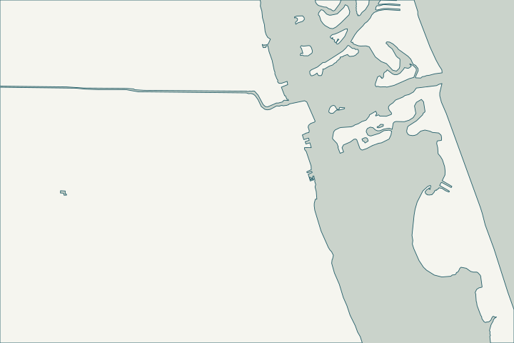
Get to know your waterfront
Moore’s Creek drains a 2,382-acre basin to the Indian River Lagoon through Fort Pierce, with its mouth near the downtown waterfront. The city widened parts of the creek for storage, added baffle boxes and built planted littoral shelves, and lists Moore’s Creek Linear Park among its parks.
Moore's Creek · About Fort Pierce · USGS GNIS streams (mouth) layer; USGS NHD flowlines
Urban stormwater and bank erosion
After Hurricane Irma, FEMA issued notice of its intent to fund the city’s repair of about two miles of Moore’s Creek between 33rd Street and 7th Street, replacing riprap, fill, vegetation and pipes. The city chose vegetative and articulating concrete stabilization, inside flood zones A/AE and the regulatory floodway.
Creek-front owners face tidal fluctuation plus urban stormwater and debris that undermine old bulkheads. A new Moore’s Creek bridge is part of the Indian River Drive project. FINAL PUBLIC NOTICE - Moore's Creek Canal Erosion Repair · Indian River Drive Corridor Improvements
What could the work cost?
For floodway lots, ask the engineer how the design meets city floodplain rules; any fill needs a permit.
Published examples are attributed context from Treasure Coast and nearby South Florida sources, not a Port St. Lucie average or a quote. Your wall needs a property-specific written scope.
Compare quotes and plan a budget →Find the relevant permits and records
| Starting point | What to resolve | Prepare and look up |
|---|---|---|
Fort Pierce Building Department | Seawall or dock permit with the city’s marine checklist. | Engineering pre-approval, Marine Permit Application, sealed plans, debris affidavit. 772-467-3718. |
Army Corps, FDEP and SFWMD | Approval letters the city checklist requires. | Flood-zone sites also get a floodplain review; flood questions 772-467-3714. |
A Moore’s Creek checklist
Use these steps to gather records and prepare a property-specific conversation. Public records and project references do not describe the condition of your wall.
Pull the permit history
Search the address on the city or county permit portal for seawall, dock and lift permits and their final inspections before the first site visit.
Check the floodway
Lots in the regulatory floodway face stricter floodplain review.
Ask about public bank work
Find whether the city’s repaired segments adjoin your lot.
Plan for the bridge project
Construction near Moore’s Creek runs to spring 2027.
Get help with your Moore’s Creek seawall
Tell us what has changed and how to reach you. We’ll help you work out the next step; photos and measurements can follow later.
Moore’s Creek project questions
Who permits creek-bank work?
The Fort Pierce Building Department, with Engineering review.
Was the creek repaired after Irma?
FEMA published notice of its intent to fund about two miles of erosion repair between 33rd and 7th streets; ask the city about completion.
Keep planning
Nearby waterfront guides
Show sourcesHide sources
- Moore's CreekSource reviewed 2026-10-25
- About Fort PierceSource reviewed 2026-10-25
- USGS GNIS streams (mouth) layer; USGS NHD flowlinesSource reviewed 2026-10-25
- FINAL PUBLIC NOTICE - Moore's Creek Canal Erosion RepairSource reviewed 2026-10-25
- Indian River Drive Corridor ImprovementsSource reviewed 2026-10-25
- BuildingSource reviewed 2026-10-25
- Checklist for Seawall PermitsSource reviewed 2026-10-25
- Marine Permit Application - Current FBCSource reviewed 2026-10-25
- Flood ProtectionSource reviewed 2026-10-25
- EngineeringSource reviewed 2026-10-25