Seawall guides by neighborhood. Find your waterfront.
Each guide covers the local water, the permit office, public records and the questions to ask about your own seawall or bulkhead.
Explore your waterfront
Explore the coast. Find your starting point.
Different shorelines need different questions. Explore permit offices, public records and project preparation for 33 Treasure Coast waterfront areas.
Full local guide
Choose a label to open local resources →Tap a community on the map or below ↗
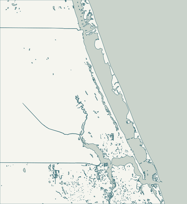
Land: U.S. Census Bureau St. Lucie and Martin county geometry minus Census water features. Points: City of Port St. Lucie GIS, Census places, St. Lucie County GIS and USGS names. Snapshot: October 25, 2026. General reference only; not a survey, flood map or service boundary.
Your local starting point
Find your community.
Choose a guide for local maps, permit starting points and the records to gather for your property.
Sandpiper Bay is one of the city’s official neighborhoods on the east bank of the North Fork. Its subdivisions include Kitching Cove Estates, The Pointe, Ballantrae, River Vista, the Tarpon Bay condominiums and the Villas of Sandpiper Bay, and it contains the River Vista, Dalhart, Farley and Van Kleef waterways. The river frontage and the River Vista waterway are tidal; confirm the status of the other waterways.
A riverfront checklist for Westmoreland and Rivergate
The Westmoreland Boulevard corridor is Port St. Lucie’s main public riverfront on the North Fork. Pioneer Park’s boardwalk runs about 3,300 feet under the Port St. Lucie Boulevard bridge, and the Port District boardwalk runs about 4,300 feet from Tom Hooper Park to the boat ramps at Veterans Park at Rivergate. Private riverfront and canal lots in River Point and Rivergate sit beside them.
Canal Pointe is the city neighborhood that holds Kingsway Waterway, the short waterway beside it and riverfront subdivisions such as Vikings Landing, Portage Cove and South River Shores. The lower C-24 canal nearby is an SFWMD-maintained ocean access waterway of about 9,330 feet with 132 adjoining lots.
Elkcam Waterway is a named Port St. Lucie waterway. In the city’s GIS it runs mainly through the Floresta Gardens and Bayshore Heights neighborhoods, with segments in Riverview and the Bayshore Business District. Its lower reach is on the city’s list of tidal ocean access waterways connected to the North Fork.
Riverview is the city neighborhood along the west bank of the North Fork that holds the Harbor (Harborview), Degan and South Coral Reef waterways, with small portions reaching Floresta Pointe and Lyngate. All three appear on the city’s list of tidal ocean access waterways, whose waterways serve 743 single-family lots in total.
Northport Village is the city neighborhood that holds the Sagamore, Surfside and Schooner waterways, with the Cove waterway at its edge. Sagamore, Surfside and Schooner are on the city’s list of tidal ocean access waterways connected to the North Fork, which exist to convey stormwater.
At the south end of Port St. Lucie, the Tesoro Community Development District (established 2005) touches Winters Creek and Blakeslee Creek, tributaries of the North Fork, while Tesoro’s internal lakes form a separate freshwater system. Nearby, the city places Vikings Lookout and Bay St Lucie in the Southbend Lakes neighborhood.
River Place on the St. Lucie is a community development district created by city ordinance in 2000 on the upper North Fork, inside the St. Lucie North neighborhood. The upper river here is narrower and fresher, with floodplain swamp and natural banks, and the community’s internal lakes are a separate stormwater system.
Most of Port St. Lucie’s roughly 200 miles of canals are freshwater drainage canals managed with water control structures, not tidal waterways. Neighborhoods such as Cashmere Cove and Palm Trails sit along the Monteray Waterway and city E-series canals, and the SFWMD’s C-24 crosses the city.
St. Lucie West is a master-planned area of Port St. Lucie served by the St. Lucie West Services District, a special district established in 1989. Its waterfront is mainly community stormwater lakes and canals rather than tidal frontage, and the 55+ Kings Isle community is platted as part of it.
Tradition is a master-planned community in western Port St. Lucie served by eleven Tradition Community Development Districts, with ten Southern Grove districts next door. Its lakes are part of the community stormwater system, so the bank behind a yard is often a district or association tract; confirm the owner on your plat.
Verano is served by five Verano community development districts and the Verano Center CDD, all established by city ordinance in 2005, and is platted as dozens of pods including Verano South. In the city’s GIS the C-24 canal touches the Verano neighborhood, while its own lakes are part of the community stormwater system.
River Park is an unincorporated community of about 6,500 residents on the upper North Fork, platted as River Park Units 1 through 10. Census and USGS data show it touching both residential canals and the river itself. Despite the Port St. Lucie mailing addresses, permits come from St. Lucie County, not the city.
Harbour Ridge Yacht & Country Club is platted as at least 21 Harbour Ridge plats and villages, and the county’s boundary layer places it in unincorporated St. Lucie County, not Palm City or Port St. Lucie. Its plats touch Winters Creek and Blakeslee Creek near the south end of the North Fork.
White City is an unincorporated community of about 3,800 residents where Midway Road marks the northern boundary of the North Fork St. Lucie Aquatic Preserve. FDEP notes 1890s settlements at Spruce Bluff and White City, and the community touches the North Fork near the mouths of Tenmile and Fivemile creeks.
Indian River Drive runs along the Indian River Lagoon between Fort Pierce and the Martin County line, past historic places USGS names Ankona, Eden, Eldred and Walton. Indian River Estates, an unincorporated community of about 6,600 residents, touches the lagoon here.
North Hutchinson Island, north of the Fort Pierce Inlet, includes lagoon-side neighborhoods such as Fort Pierce Shores, Queens Cove, Coastal Cove and Coral Cove. The lagoon here is part of the Indian River–Vero Beach to Fort Pierce Aquatic Preserve, an Outstanding Florida Water of seagrass, oyster reef and mangrove.
The Hutchinson Island South community counted about 5,000 residents but 6,400 housing units in 2020, so many owners are seasonal or condominium associations. It includes Nettles Island, Waveland and Herman Bay on the lagoon side, and oceanfront condominiums behind dunes protected by a 3.3-mile federal storm-risk project.
Fort Pierce, incorporated in 1901, has about 47,000 residents and an urban lagoon front around its City Marina, which is protected by a constructed island system. Residential lagoon lots run along Indian River Drive, where a $10.25 million corridor project from Seaway Drive to Marina Way is due to finish in spring 2027.
Moore’s Creek drains a 2,382-acre basin to the Indian River Lagoon through Fort Pierce, with its mouth near the downtown waterfront. The city widened parts of the creek for storage, added baffle boxes and built planted littoral shelves, and lists Moore’s Creek Linear Park among its parks.
Causeway Island sits in the lagoon just west of the Fort Pierce Inlet along Seaway Drive. County records show Harbour Isle at Hutchinson Island and its east and west condominiums there, inside Fort Pierce city limits, and the city lists Causeway Park among its parks.
South Beach is the Fort Pierce portion of South Hutchinson Island, from the inlet south to about latitude 27.433, where unincorporated county land begins. Beaches south of the inlet jetties, built in 1921, erode persistently, and the federal Fort Pierce Shore Protection Project has renourished them 14 times since 1980.
St. Lucie Village, settled in 1843 and incorporated in 1961, runs between U.S. 1 and the Indian River Lagoon north of Fort Pierce, and its oldest part is a National Register Historic District. A 2023 state funding request said most of the Village sits at sea level and floods in king tides and major storms.
Stuart has about 17,400 residents along the St. Lucie River and its tidal creeks: Frazier, Krueger, Poppleton and Haney. The city’s redevelopment area covers about 1,168 acres north and south of the Roosevelt Bridge, including the historic downtown riverfront and much of the Haney Creek conservation area.
The Town of Sewall’s Point has more water than land inside its limits (about 2.95 square miles of water to 1.18 of land), with the Indian River Lagoon on one side and the St. Lucie River on the other. Its 2018 funding request called South Sewall’s Point Road the only evacuation route for 730 homes.
Jensen Beach is an unincorporated Martin County community of about 12,700 residents on the Indian River Lagoon, inside the Jensen Beach to Jupiter Inlet Aquatic Preserve. Indian River Drive frontage, the Jensen Beach Causeway and county parks such as Indian Riverside Park shape its waterfront.
Rio is a small unincorporated Martin County community of about 980 residents on the St. Lucie River, near Krueger Creek. The Rio Marine Village plan approved in 2025 covers almost 3,000 linear feet of river frontage, mostly hardened with existing boat basins, with a 25-foot shoreline protection zone.
North River Shores is an unincorporated Martin County community of about 3,500 residents on the lower North Fork, with river points USGS names Speedy, Arbeau, Bessey and Dyer, and Jenkins Point just west of the Roosevelt Bridge. The North Fork aquatic preserve’s southern boundary runs from Coconut Point to Jenkins Point.
Palm City is an unincorporated Martin County community of about 25,900 residents where the North Fork, South Fork, St. Lucie Canal (C-44) and creeks such as Mapps, Danforth and Bessey meet. Jenkins Point in Palm City marks part of the North Fork aquatic preserve’s southern boundary.
Port Salerno is an unincorporated Martin County community of about 10,400 residents around Manatee Pocket near the St. Lucie Inlet, home to the county’s last commercial fishing dock. The inlet, cut by residents in 1892 and nearly half a mile wide today, is dredged every two to four years.
Sailfish Point occupies the southern tip of Hutchinson Island at the St. Lucie Inlet, reached by MacArthur Boulevard past Bathtub Beach. Martin County’s resilience project raised the 1,100-foot stretch between Bathtub Beach and Sailfish Point from about 2.5 to 5.25 feet and buried a sheet-pile seawall under the dune.
Martin County’s part of Hutchinson Island runs from the St. Lucie County line south past the Jensen Beach Causeway and Stuart Beach. The county has maintained its northern four miles of coast against erosion since 1996 with the Army Corps and FDEP, on an eight-year nourishment cycle.
Ocean Breeze began as a trailer park founded in 1938; its 142 property owners voted to incorporate the 65-acre park in 1960, and the town dropped “Park” from its name in 2013. About 300 residents live there on the Indian River Lagoon, within the Jensen Beach area.