Canal Pointe & Kingsway seawall planning
Seawall planning in Canal Pointe, Port St. Lucie: Kingsway Waterway dredging, the tidal lower C-24, Vikings Landing, SFWMD rules and city permits.
Describe your project on this page ↓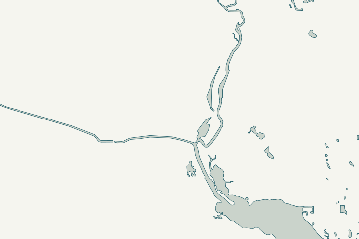
Get to know your waterfront
Canal Pointe is the city neighborhood that holds Kingsway Waterway, the short waterway beside it and riverfront subdivisions such as Vikings Landing, Portage Cove and South River Shores. The lower C-24 canal nearby is an SFWMD-maintained ocean access waterway of about 9,330 feet with 132 adjoining lots.
Port St. Lucie Subdivisions layer · Ocean Access Waterways – Public Works Department (Waterway Maintenance Presentation)
Two kinds of canal, two maintenance owners
Kingsway is a city-maintained tidal waterway; the lower C-24 is maintained by the South Florida Water Management District. Work in or across the C-24 right-of-way needs an SFWMD 40E-6 permit, and the district keeps a 40-foot strip from top of bank for maintenance.
The city’s 2021 dredging plan put Kingsway in year 1, funded by the half-cent sales tax. A slow speed/minimum wake zone applies within 300 feet of the SE Southbend Blvd bridge over the C-24. Dredging of Ocean Access Waterways – Public Works Department (Waterway Maintenance – Updated 10-18-21) · Fla. Admin. Code R. 40E-6.011 - Policy and Purpose · Ordinance 24-83
What could the work cost?
On the C-24, include the SFWMD permit and any strip restrictions in the scope. On Kingsway, ask whether land access from the yard is possible to avoid barge costs.
Published examples are attributed context from Treasure Coast and nearby South Florida sources, not a Port St. Lucie average or a quote. Your wall needs a property-specific written scope.
Compare quotes and plan a budget →Find the relevant permits and records
| Starting point | What to resolve | Prepare and look up |
|---|---|---|
Port St. Lucie Building Department | City permit for the seawall (permit type SWL), dock (DK) or boat lift (BL). | Sealed plans, plot plan with setbacks and Notice of Commencement for work of $5,000 or more. 772-871-5132. |
FDEP, Army Corps and SFWMD | State exemption or permit, federal authorization and water-management approval the city asks to see. | Show the new wall face relative to the old one (18-inch rule). FDEP Southeast District: 561-681-6600. |
South Florida Water Management District | Right of Way Occupancy Permit for structures in or across District canals (C-23, C-24, C-25). | Locate the 40-foot maintenance strip from top of bank on your survey. |
A Canal Pointe checklist
Use these steps to gather records and prepare a property-specific conversation. Public records and project references do not describe the condition of your wall.
Pull the permit history
Search the address on the city or county permit portal for seawall, dock and lift permits and their final inspections before the first site visit.
Confirm which canal you are on
Kingsway (city) or the lower C-24 (SFWMD) changes who reviews structures in the waterway.
Port St. Lucie Subdivisions layer · Works of the District Subject to Chapter 40E-6, F.A.C. (Right of Way Occupancy Permits)
Check the right-of-way
On the C-24, locate the 40-foot maintenance strip and ask SFWMD whether a notice general permit (no fee) applies.
Fla. Admin. Code R. 40E-6.011 - Policy and Purpose · Fla. Admin. Code R. 40E-6.601 - Permit Application Processing Fees
Ask about dredging status
Ask Public Works whether the scheduled Kingsway dredging was completed and how deep the center channel is.
Get help with your Canal Pointe & Kingsway seawall
Tell us what has changed and how to reach you. We’ll help you work out the next step; photos and measurements can follow later.
Canal Pointe & Kingsway project questions
Is the C-24 here salt or fresh?
The city lists the lower C-24 as a tidal ocean access waterway maintained by SFWMD. Upstream reaches behind control structures are freshwater.
Ocean Access Waterways – Public Works Department (Waterway Maintenance Presentation) · Works of the District Subject to Chapter 40E-6, F.A.C. (Right of Way Occupancy Permits)
Does the city repair private seawalls?
No program was found; the city maintains waterways for stormwater, and walls and docks are the owner’s responsibility.
Keep planning
Nearby waterfront guides
Westmoreland & Port District, Sandpiper Bay, Tesoro & Southbend, Floresta & Elkcam Waterway
Show sourcesHide sources
- Port St. Lucie Subdivisions layerSource reviewed 2026-10-25
- Ocean Access Waterways – Public Works Department (Waterway Maintenance Presentation)Source reviewed 2026-10-25
- Dredging of Ocean Access Waterways – Public Works Department (Waterway Maintenance – Updated 10-18-21)Source reviewed 2026-10-25
- Fla. Admin. Code R. 40E-6.011 - Policy and PurposeSource reviewed 2026-10-25
- Ordinance 24-83Source reviewed 2026-10-25
- Building DepartmentSource reviewed 2026-10-25
- Permit Type Codes (permittypebytypecode.pdf)Source reviewed 2026-10-25
- Building Department Checklist for Dock PermitsSource reviewed 2026-10-25
- Florida Statutes s. 403.813 - Permits issued at district centers; exceptionsSource reviewed 2026-10-25
- Southeast DistrictSource reviewed 2026-10-25
- Fla. Admin. Code R. 40E-6.041 - Consent RequiredSource reviewed 2026-10-25
- Works of the District Subject to Chapter 40E-6, F.A.C. (Right of Way Occupancy Permits)Source reviewed 2026-10-25
- Fla. Admin. Code R. 40E-6.601 - Permit Application Processing FeesSource reviewed 2026-10-25