South Beach (Fort Pierce) waterfront planning
Oceanfront armoring and lagoon seawalls on Fort Pierce South Beach: Jetty Park erosion, 2026 renourishment, CCCL conditional use and city flood rules.
Describe your project on this page ↓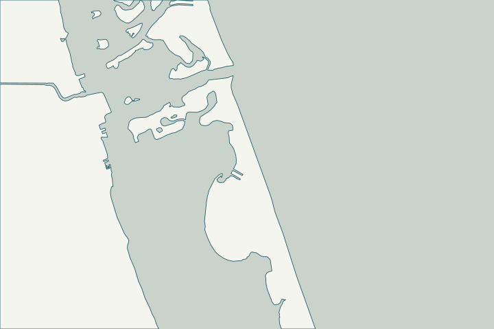
Get to know your waterfront
South Beach is the Fort Pierce portion of South Hutchinson Island, from the inlet south to about latitude 27.433, where unincorporated county land begins. Beaches south of the inlet jetties, built in 1921, erode persistently, and the federal Fort Pierce Shore Protection Project has renourished them 14 times since 1980.
St. Lucie County Municipal Boundaries layer · Florida beach is state's most-eroded, costing $15M every two years (Timothy O'Hara, Apr. 28, 2026) · Fort Pierce Shore Protection Project
Erosion emergencies and armoring
In early 2026 Fort Pierce declared a local beach-erosion emergency; the county placed more than 10,000 cubic yards of stop-gap sand, and the Corps then placed about 400,000 cubic yards under a $15.1 million contract. Offshore T-groins have been proposed as a longer-term fix.
Construction seaward of the CCCL inside city limits needs a city conditional use approval and FDEP approval. East of the CCCL, the lowest horizontal structural member must meet the stricter of the city elevation or DEP’s 100-year storm elevation. Fort Pierce beach erosion fix holding strong ahead of $15 million renourishment project this month · Staff Packet - 324 South Ocean Drive (Conditional Use with New Construction and Design Review, seaward of CCCL) · Floodplain Regulations
What could the work cost?
Oceanfront projects need CCCL, conditional use and turtle-season timing in the schedule; lagoon-side walls follow the normal city route.
Published examples are attributed context from Treasure Coast and nearby South Florida sources, not a Port St. Lucie average or a quote. Your wall needs a property-specific written scope.
Compare quotes and plan a budget →Find the relevant permits and records
| Starting point | What to resolve | Prepare and look up |
|---|---|---|
Fort Pierce Building Department | Seawall or dock permit with the city’s marine checklist. | Engineering pre-approval, Marine Permit Application, sealed plans, debris affidavit. 772-467-3718. |
FDEP Coastal Construction Control Line program | Construction, armoring and excavation seaward of the CCCL on the Atlantic side. | Post-storm cap and tieback repairs need local authorization under an emergency order; replacement needs a CCCL permit. 850-245-8570. |
Army Corps, FDEP and SFWMD | Approval letters the city checklist requires. | Flood-zone sites also get a floodplain review; flood questions 772-467-3714. |
A South Beach checklist
Use these steps to gather records and prepare a property-specific conversation. Public records and project references do not describe the condition of your wall.
Pull the permit history
Search the address on the city or county permit portal for seawall, dock and lift permits and their final inspections before the first site visit.
Confirm city or county
The city line ends near latitude 27.433.
Plan the conditional use
Work seaward of the CCCL needs city conditional use approval.
Know the emergency rules
Temporary armoring must be removed or permitted within 60 days.
Florida Statutes s. 161.085 - Rigid coastal armoring structures
Get help with your South Beach, Fort Pierce seawall
Tell us what has changed and how to reach you. We’ll help you work out the next step; photos and measurements can follow later.
South Beach, Fort Pierce project questions
Why does this beach erode so much?
The 1921 inlet jetties changed sand flow; renourishment is needed regularly.
Florida beach is state's most-eroded, costing $15M every two years (Timothy O'Hara, Apr. 28, 2026)
Who funds renourishment?
The 2026 project was about 78% federal and 22% from the county Erosion District.
Fort Pierce beach renourishment project set to begin as erosion threat stabilizes
Keep planning
Nearby waterfront guides
Causeway Island, South Hutchinson Island, Downtown Fort Pierce
Show sourcesHide sources
- St. Lucie County Municipal Boundaries layerSource reviewed 2026-10-25
- Florida beach is state's most-eroded, costing $15M every two years (Timothy O'Hara, Apr. 28, 2026)Source reviewed 2026-10-25
- Fort Pierce Shore Protection ProjectSource reviewed 2026-10-25 · official indexed text
- Fort Pierce beach erosion fix holding strong ahead of $15 million renourishment project this monthSource reviewed 2026-10-25
- Staff Packet - 324 South Ocean Drive (Conditional Use with New Construction and Design Review, seaward of CCCL)Source reviewed 2026-10-25
- Floodplain RegulationsSource reviewed 2026-10-25
- BuildingSource reviewed 2026-10-25
- Checklist for Seawall PermitsSource reviewed 2026-10-25
- Marine Permit Application - Current FBCSource reviewed 2026-10-25
- Apply - Coastal Construction Control Line (CCCL) PermittingSource reviewed 2026-10-25
- Post-Storm Guidance: Coastal Construction Control Line (public handout)Source reviewed 2026-10-25
- Coastal Construction Control Line Emergency PermittingSource reviewed 2026-10-25
- Flood ProtectionSource reviewed 2026-10-25
- Florida Statutes s. 161.085 - Rigid coastal armoring structuresSource reviewed 2026-10-25
- Fort Pierce beach renourishment project set to begin as erosion threat stabilizesSource reviewed 2026-10-25