Sandpiper Bay seawall planning
Seawall and dock planning in Sandpiper Bay, Port St. Lucie: River Vista and Dalhart waterways, the North Fork aquatic preserve, mangroves and permits.
Describe your project on this page ↓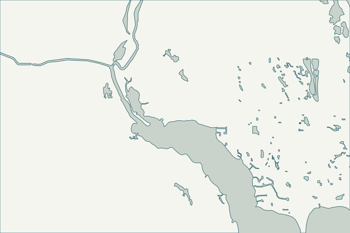
Get to know your waterfront
Sandpiper Bay is one of the city’s official neighborhoods on the east bank of the North Fork. Its subdivisions include Kitching Cove Estates, The Pointe, Ballantrae, River Vista, the Tarpon Bay condominiums and the Villas of Sandpiper Bay, and it contains the River Vista, Dalhart, Farley and Van Kleef waterways. The river frontage and the River Vista waterway are tidal; confirm the status of the other waterways.
Port St. Lucie Neighborhoods (NS_NEIGHBORHOODS) layer · Port St. Lucie Subdivisions layer · Port St. Lucie Drainage: Canals layer · Ocean Access Waterways – Public Works Department (Waterway Maintenance Presentation)
Brackish water, mangroves and the preserve line
On brackish North Fork frontage, ask the inspector to look for rust staining at cap cracks and to probe the toe at low water; NOAA’s nearby North Fork station shows a mean tide range of about one foot.
Mangrove fringe is common here. In a 2024 state order, the Sandpiper Bay Resort was fined $110,395 after an estimated 944 mangroves were cut without a permit, and was required to replant 2,780. Any wall or dock work near mangroves needs to follow the state trimming rules.
River frontage lies in or beside the North Fork St. Lucie Aquatic Preserve, an Outstanding Florida Water. Replacing a wall in the same footprint is usually simpler than building out. Datums for 8722334, North Fork (St. Lucie River) FL · DEP issues final order to punish Port St. Lucie resort for destroying mangrove forest (Katie Delk, Jan. 2024) · North Fork, St. Lucie Aquatic Preserve
What could the work cost?
Ask for separate prices for barge versus land access, turbidity barriers and any mangrove-trimming work by a qualified trimmer. Condominium walls at Tarpon Bay are usually association decisions.
Published examples are attributed context from Treasure Coast and nearby South Florida sources, not a Port St. Lucie average or a quote. Your wall needs a property-specific written scope.
Compare quotes and plan a budget →Find the relevant permits and records
| Starting point | What to resolve | Prepare and look up |
|---|---|---|
Port St. Lucie Building Department | City permit for the seawall (permit type SWL), dock (DK) or boat lift (BL). | Sealed plans, plot plan with setbacks and Notice of Commencement for work of $5,000 or more. 772-871-5132. |
FDEP, Army Corps and SFWMD | State exemption or permit, federal authorization and water-management approval the city asks to see. | Show the new wall face relative to the old one (18-inch rule). FDEP Southeast District: 561-681-6600. |
FDEP state lands (aquatic preserve) | Consent to use state-owned bottom land in the North Fork St. Lucie Aquatic Preserve. | Ask whether the wall moves more than one foot waterward; preserve dock standards apply. |
A Sandpiper Bay waterfront checklist
Use these steps to gather records and prepare a property-specific conversation. Public records and project references do not describe the condition of your wall.
Pull the permit history
Search the address on the city or county permit portal for seawall, dock and lift permits and their final inspections before the first site visit.
Identify your water
Find which waterway or river reach fronts the lot (River Vista, Dalhart, Farley, Van Kleef or the North Fork) on the city canal map.
Map the mangroves
Mark mangroves on the survey before design. Trimming limits and penalties are strict, as the 2024 resort case showed.
Confirm dock limits
On canal lots, docks may extend only 5 feet into the waterway; lifts may extend 10 feet beyond the dock on waterways at least 60 feet wide.
Get help with your Sandpiper Bay seawall
Tell us what has changed and how to reach you. We’ll help you work out the next step; photos and measurements can follow later.
Sandpiper Bay project questions
Is my Sandpiper Bay canal tidal?
The River Vista waterway is on the city’s list of tidal ocean access waterways connected to the river. Confirm your specific waterway with the city canal map and a site visit.
Ocean Access Waterways – Public Works Department (Waterway Maintenance Presentation)
Who maintains the waterway?
The city maintains its ocean access waterways to convey stormwater, not for navigation. Your seawall and dock are your responsibility.
When was River Vista last dredged?
The city’s 2021 five-year plan scheduled River Vista for dredging in year 5. Ask Public Works for the current status.
Keep planning
Nearby waterfront guides
Tesoro & Southbend, Canal Pointe & Kingsway, Westmoreland & Port District, Harbour Ridge
Show sourcesHide sources
- Port St. Lucie Neighborhoods (NS_NEIGHBORHOODS) layerSource reviewed 2026-10-25
- Port St. Lucie Subdivisions layerSource reviewed 2026-10-25
- Port St. Lucie Drainage: Canals layerSource reviewed 2026-10-25
- Ocean Access Waterways – Public Works Department (Waterway Maintenance Presentation)Source reviewed 2026-10-25
- Datums for 8722334, North Fork (St. Lucie River) FLSource reviewed 2026-10-25
- DEP issues final order to punish Port St. Lucie resort for destroying mangrove forest (Katie Delk, Jan. 2024)Source reviewed 2026-10-25
- North Fork, St. Lucie Aquatic PreserveSource reviewed 2026-10-25
- Building DepartmentSource reviewed 2026-10-25
- Permit Type Codes (permittypebytypecode.pdf)Source reviewed 2026-10-25
- Building Department Checklist for Dock PermitsSource reviewed 2026-10-25
- Florida Statutes s. 403.813 - Permits issued at district centers; exceptionsSource reviewed 2026-10-25
- Southeast DistrictSource reviewed 2026-10-25
- Fla. Admin. Code R. 18-20.004 - Management Policies, Standards, and CriteriaSource reviewed 2026-10-25
- § 158.217 Accessory Uses and Structures (Port St. Lucie Code of Ordinances, Ch. 158 Zoning Code, Art. XI)Source reviewed 2026-10-25
- Dredging of Ocean Access Waterways – Public Works Department (Waterway Maintenance – Updated 10-18-21)Source reviewed 2026-10-25