
Stuart seawall planning
Seawall and bulkhead planning in Stuart: Frazier, Krueger, Poppleton and Haney creeks, downtown riverfront, city permits and state-licensed contractors.
Describe your project on this page ↓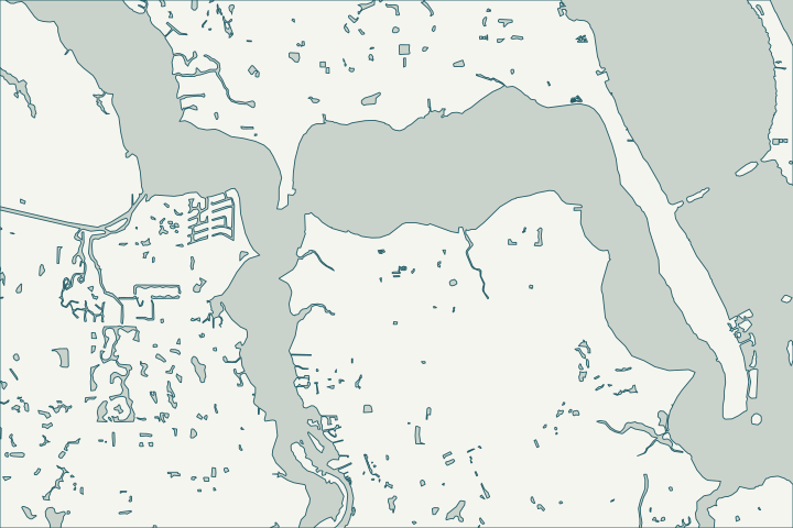
Get to know your waterfront
Stuart has about 17,400 residents along the St. Lucie River and its tidal creeks: Frazier, Krueger, Poppleton and Haney. The city’s redevelopment area covers about 1,168 acres north and south of the Roosevelt Bridge, including the historic downtown riverfront and much of the Haney Creek conservation area.
TIGERweb Census 2020 Incorporated Places layer (POP100, HU100 fields) · Community Redevelopment Agency (CRA)
Narrow creeks and city permits
Bulkheads on narrow creeks are prone to toe scour and tie-back failure. During Nicole, the USGS Stuart gauge recorded a 3.64-foot storm tide and the downtown boardwalk and finger piers were damaged. Stuart’s Tressler Drive baffle box treats runoff that once flowed straight to Poppleton Creek.
Stuart permits work inside city limits through its OpenGov portal, and since July 1, 2025 it no longer accepts county certificates of competency. Stuart is not listed in FEMA’s CRS program. Tropical Cyclone Report: Hurricane Nicole · Tropical Storm Nicole: Live updates, what to know Thursday about storm's impact to Martin County (Nov. 10-11, 2022) · City of Stuart Stormwater Project Recognized as Project of the Year (May 19, 2023) · Building Division
What could the work cost?
Ask bidders for their state license number up front; county-only certificates are no longer accepted in Stuart.
Published examples are attributed context from Treasure Coast and nearby South Florida sources, not a Port St. Lucie average or a quote. Your wall needs a property-specific written scope.
Compare quotes and plan a budget →Find the relevant permits and records
| Starting point | What to resolve | Prepare and look up |
|---|---|---|
City of Stuart Building Division | City permit for seawalls and docks inside city limits. | OpenGov portal; state-registered or certified contractor. 772-288-5326. |
FDEP and Army Corps | State exemption or permit and federal authorization. | FDEP Southeast District: 561-681-6600. |
A Stuart checklist
Use these steps to gather records and prepare a property-specific conversation. Public records and project references do not describe the condition of your wall.
Pull the permit history
Search the address on the city or county permit portal for seawall, dock and lift permits and their final inspections before the first site visit.
Confirm city limits
Some riverfront neighborhoods nearby are unincorporated county.
Verify state licensure
Stuart requires state-registered or certified contractors.
Check flood-zone rules
Florida’s small-project exemption does not apply in flood zones or to structural work.
Get help with your Stuart seawall
Tell us what has changed and how to reach you. We’ll help you work out the next step; photos and measurements can follow later.
Stuart project questions
Does Stuart get a flood insurance discount?
Stuart does not appear on FEMA’s October 2026 CRS list.
Which manatee zones apply?
Martin County’s zones in Rule 68C-22.024 make most inland waters within 600 feet of shore slow speed.
Keep planning
Nearby waterfront guides
Show sourcesHide sources
- TIGERweb Census 2020 Incorporated Places layer (POP100, HU100 fields)Source reviewed 2026-10-25
- Community Redevelopment Agency (CRA)Source reviewed 2026-10-25
- Tropical Cyclone Report: Hurricane NicoleSource reviewed 2026-10-25
- Tropical Storm Nicole: Live updates, what to know Thursday about storm's impact to Martin County (Nov. 10-11, 2022)Source reviewed 2026-10-25
- City of Stuart Stormwater Project Recognized as Project of the Year (May 19, 2023)Source reviewed 2026-10-25
- Building DivisionSource reviewed 2026-10-25
- Southeast DistrictSource reviewed 2026-10-25
- Reissuance and Modification of Nationwide PermitsSource reviewed 2026-10-25
- New Rules Related to Building Permit ExemptionsSource reviewed 2026-10-25
- CRS Eligible Communities, October 1, 2026 Effective DateSource reviewed 2026-10-25
- Fla. Admin. Code R. 68C-22.024 - Martin County ZonesSource reviewed 2026-10-25