
Northport Village waterways seawall planning
Seawall planning in Northport Village, Port St. Lucie: the Sagamore, Surfside, Schooner and Cove waterways, dredging plans, wake zones and permits.
Describe your project on this page ↓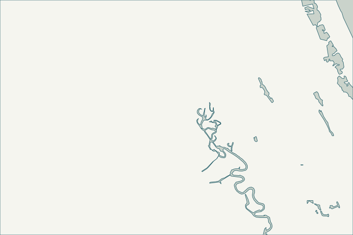
Get to know your waterfront
Northport Village is the city neighborhood that holds the Sagamore, Surfside and Schooner waterways, with the Cove waterway at its edge. Sagamore, Surfside and Schooner are on the city’s list of tidal ocean access waterways connected to the North Fork, which exist to convey stormwater.
Port St. Lucie Drainage: Canals layer · Ocean Access Waterways – Public Works Department (Waterway Maintenance Presentation) · Ocean Access Waterways – Public Works Department
Sediment, depth and the wall toe
Sagamore, Surfside and Schooner were dredged in 2010, and the 2021 five-year plan put Sagamore first in line again. Shallow water can tempt owners to extend docks or lifts; on canal lots, docks may protrude only 5 feet and lifts up to 10 feet beyond the dock where the waterway is 60 feet wide or more.
When a canal shoals, the wall’s toe is buried in soft sediment that can scour away after dredging. Ask the inspector how the toe will be checked and whether a dredging project nearby changes the design. Ocean Access Waterways – Public Works Department · Dredging of Ocean Access Waterways – Public Works Department (Waterway Maintenance – Updated 10-18-21) · § 158.217 Accessory Uses and Structures (Port St. Lucie Code of Ordinances, Ch. 158 Zoning Code, Art. XI)
What could the work cost?
Ask how dredging next to the wall, if any, is priced and permitted separately from the wall work.
Published examples are attributed context from Treasure Coast and nearby South Florida sources, not a Port St. Lucie average or a quote. Your wall needs a property-specific written scope.
Compare quotes and plan a budget →Find the relevant permits and records
| Starting point | What to resolve | Prepare and look up |
|---|---|---|
Port St. Lucie Building Department | City permit for the seawall (permit type SWL), dock (DK) or boat lift (BL). | Sealed plans, plot plan with setbacks and Notice of Commencement for work of $5,000 or more. 772-871-5132. |
FDEP, Army Corps and SFWMD | State exemption or permit, federal authorization and water-management approval the city asks to see. | Show the new wall face relative to the old one (18-inch rule). FDEP Southeast District: 561-681-6600. |
Port St. Lucie Public Works | City waterway easements, storm outfalls and encroachment permits. | Signed and sealed survey for a revocable encroachment permit ($125 plus recording). 772-871-5100. |
A Northport Village checklist
Use these steps to gather records and prepare a property-specific conversation. Public records and project references do not describe the condition of your wall.
Pull the permit history
Search the address on the city or county permit portal for seawall, dock and lift permits and their final inspections before the first site visit.
Ask about dredging timing
If the city plans dredging in your waterway, coordinate the wall work so a newly exposed toe is designed for.
Check lift clearance
Measure low-tide depth at the lift; residents elsewhere in the city have reported boats stuck on lifts.
'It's upsetting': Port St. Lucie residents voice frustration over shallow drainage canal
Read the dock limits
Confirm the waterway width before designing a new dock or lift.
Get help with your Northport Village seawall
Tell us what has changed and how to reach you. We’ll help you work out the next step; photos and measurements can follow later.
Northport Village project questions
Does the city keep these canals deep for boats?
No. The city’s policy is that ocean access waterways exist to convey stormwater; navigation dredging would need a special assessment district.
How much does a permit cost?
The published residential seawall permit fee is $100 for the first 100 feet, then $5 for each additional foot, plus state surcharges. Confirm the current amount before applying.
Keep planning
Nearby waterfront guides
Riverview, Floresta & Elkcam Waterway, River Place & St. Lucie North, River Park
Show sourcesHide sources
- Port St. Lucie Drainage: Canals layerSource reviewed 2026-10-25
- Ocean Access Waterways – Public Works Department (Waterway Maintenance Presentation)Source reviewed 2026-10-25
- Dredging of Ocean Access Waterways – Public Works Department (Waterway Maintenance – Updated 10-18-21)Source reviewed 2026-10-25
- § 158.217 Accessory Uses and Structures (Port St. Lucie Code of Ordinances, Ch. 158 Zoning Code, Art. XI)Source reviewed 2026-10-25
- Building DepartmentSource reviewed 2026-10-25
- Permit Type Codes (permittypebytypecode.pdf)Source reviewed 2026-10-25
- Building Department Checklist for Dock PermitsSource reviewed 2026-10-25
- Florida Statutes s. 403.813 - Permits issued at district centers; exceptionsSource reviewed 2026-10-25
- Southeast DistrictSource reviewed 2026-10-25
- Public WorksSource reviewed 2026-10-25
- Residential Revocable Encroachment Permit Application / Permit Info / Permit formSource reviewed 2026-10-25
- 'It's upsetting': Port St. Lucie residents voice frustration over shallow drainage canalSource reviewed 2026-10-25
- Residential Permit Fee ScheduleSource reviewed 2026-10-25